|
|
 |
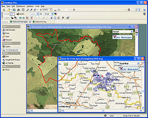
 LandMap Vivo - short description
-
Create GPS enabled geo maps directly on the background of aereal photos and road
maps from the internet
-
Import geodata from Google-Earth, OpenStreetMap, GPS tracks and GPS logger
-
Map editor
, manually digitizing
- Specifical graphical objects (borderlines, borderareas) to guarantee exact same
borders of neighbour areas
-
Layer management
- Insert own symbols (trees, building, etc.), labeling the map
- Screen calibration for true to display on the screnn
- Free scalable
-
Measurements:
-
area size (hectares, acres) of an arbitrary number of areas
- total area, net area,
restricted area
- recorgnizes automatically embedded areas
- measure of paths
- True to scale print of map sections
- Export to "Google Earth" as vector map
- Export as Pixel-Image (jpg, gif, png, tiff, bitmap)
|